08 / 01 / 2020

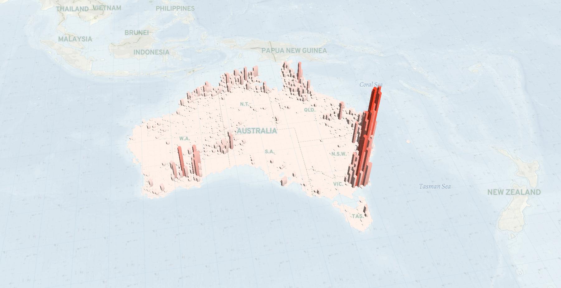
A visual representation of Australia’s devastating fires

Fires in Australia are estimated to have burned 107,000 square kilometers, nearly the size of mainland Greece (132,049). 28 people died and more than a billion animals killed in wildfires that have been burning the country since autumn 2019.

Credits

Research:

Data Visualization:

Tags:

Fires in Australia are estimated to have burned 107,000 square km, nearly the size of mainland Greece (132,049). 28 people died and more than a billion animals were killed in wildfires that have been burning the country since the autumn of 2019.

The map shows a three-dimensional representation of the locations most affected by the fires as NASA tracks them in satellite images. The highest column represents 18,424 fires covering an area of approximately 2,500 square km from October 1st, 2019 to January 6th, 2020. (Source)

To change the viewing angle of the 3D map, press Ctrl and drag the mouse in the desired direction.

More to read

Before you go, can you chip in?

Quality journalism is not of no cost. If you think what we do is important, please consider donating and becoming a reader who makes our work possible.